Glossy Black-Cockatoo Habitat Mapping for the SEQ Bioregion
This project is proudly supported by the WIRES National Grants Program
Southeast Queensland (SEQ) has the fastest growing human population in Australia and provides critical habitat for the nationally vulnerable south-eastern Glossy Black-Cockatoo (Calyptorhynchus lathami lathami). Hundreds of thousands of hectares of Glossy Black-Cockatoo habitat were burnt during the 2019-20 wildfires, including across SEQ.
Updating the maps
Habitat mapping for South-eastern Glossy Black-Cockatoo was last undertaken in 2016, which means land use, planning and policy decisions are being made with using information that is a decade out-of-date. Since 2016, thanks to our dedicated researchers and volunteer citizen scientists, the Conservancy has collected more than 6000 records of sightings. Together with data from partner organisations such as Birdlife Australia, the Queensland Government and local Council partners, we are updating the habitat maps to better inform our knowledge and to influence planning decisions.
Thanks to the support of a WIRES Pat Connors Avian Grant, the Glossy Black Conservancy is updating habitat mapping for Glossy Black-Cockatoo in Southeast Queensland.
Upcoming Webinar
Want to know more about the new habitat maps, what they mean and how to use them?
We’ll be hosting a free webinar to explain the mapping methodology and taxon rules, demonstrate their functionality and application and identify habitat changes that have occurred over the last 10 years. Register below.
2-3:30pm Tuesday 21 October
Mapping for Conservation Across Queensland
This webinar will focus on:
🔹 How habitat availability has shifted in the past decade
🔹 How mapping supports population recovery planning for Glossy Black-Cockatoo
🔹 Opportunities to adapt the methodology for other regions and species
🔹 Ways agencies, researchers, governments and community can access and apply mapping for better data-driven conservation
Join us to discover how updated habitat mapping can inform stronger conservation outcomes, not just for Glossies but for wildlife across Queensland.
Taxon Profile
A taxon profile is a comprehensive summary of biological, ecological, and distributional information about a specific species or subspecies. In order to accurately update the habitat mapping for South-eastern Glossy Black-Cockatoo, we also need to update its taxon profile. This detailed document outlines the known characteristics, ecological requirements, and habitat preferences of a species or subspecies. It includes information such as scientific classification, distribution, breeding and feeding behaviour, threats, and key habitat attributes.
2025 SEQ Habitat Maps - currently being finalised
2017 SEQ Habitat Maps
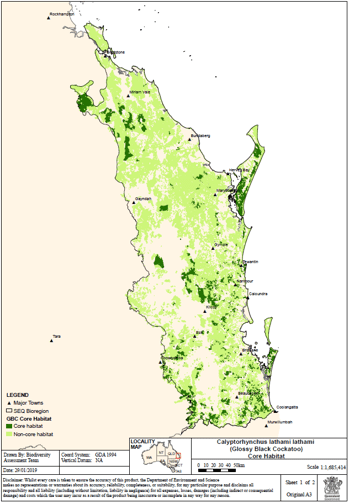
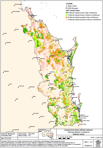
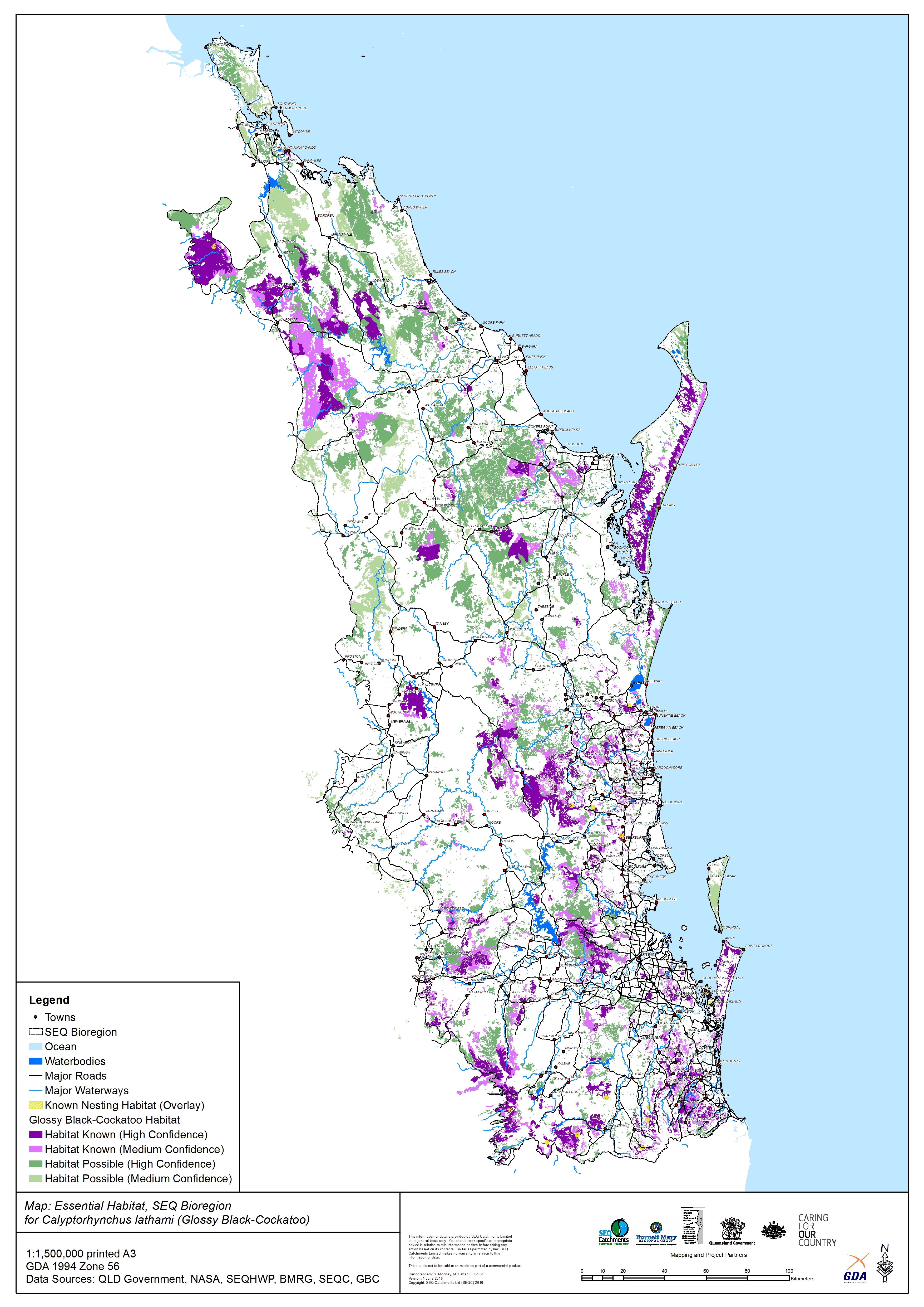
Core Habitat
Habitat Value
Essential Habitat
Mapping rules
Together with the updated taxon profile, the mapping rules determine the how, what, when and why behind the maps. The rules ensure scientific rigor and consistency when interpreting habitat use and combining various data sets across the region.
Map uses
Habitat mapping is used for many purposes and most commonly for environmental impact assessments and Matters of State Environmental Significance, commonly used in Queensland, in environmental planning and assessments.
Other uses include:
– Identifying the extent of impact of extreme weather events, e.g., the 2019-20 wildfires affected 56,400 hectares across SEQ
– Assessing planning impacts, e.g., ShapingSEQ 2023 review :
+ 18,800+ hectares within Urban Footprint
+ 3,850 hectares within Rural Living Area
+ proposed changes include 100+ hectares
– guiding research and surveys, e.g.,focusing citizen science efforts
– fire management planning
– local government planning and extension support
With thanks to the WIRES national grant program for funding this essential mapping work.

Photography © Andrew Peacock
footloosefotography.com | instagram.com/footloosefotography
